![]()
History of African-Americans in Buffalo ................ Bird Island Pier................... Niagara Street Industrial Heritage
Freedom
Park
Former name: Broderick Park
1170 Niagara St.,
Buffalo, NY
Broderick Park, following an elongated shape, is located on the
southern tip of Unity Island between the Niagara River and the Black
Rock Canal.
The park overlooks the CanadaUS border and is situated within view
of the Peace
Bridge.
|
Because of its historic significance, the name of Broderick
Park
is being changed to Freedom Park, to better tell the
story of the black freedom movement and hard-fought civil
rights. Buffalos Common Council has
officially approved the renaming of the park via a resolution.
The decision to rename the park was agreed upon by the
Friends of Broderick Park, the Broderick Family, and the
citizens of Buffalo.To ensure that the legacy of Michael
Broderick one of the founders of the
West
Side Rowing Club remains intact, there will be a
commemorative memorial installed at the site. Freedom Park is located at the foot of West Ferry 3 Bird Island Pier and 92 West Ferry Street. - Queenseyes, Buffalo Common Council Officially Approves the Renaming of Broderick Park to "Freedom Park, November 1, 2023" (online December 2023)
|
| One
of Buffalo's oldest parks is getting some substantial
renovations. Broderick Park
at the foot of Ferry Street will receive nearly $1.5 million in
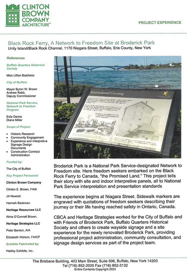
improvements. Major renovations for the historic site were unveiled Thursday night at a public meeting at Rich Renaissance Center. Buffalo Niagara Riverkeeper Executive Director Jill Jedlicka says her group has long been involved in planning for the park "When you approach it by Niagara Street, most folks don't even know it is there," said Jedlilcka. "And you see the Peace Bridge and you see the flowing Niagara, and you really feel all the beauty and history at that site, that's what makes it so special." The park is little-known and well-known. A key element in the history of slavery and freedom on the Underground Railroad and a key recreational element for the growing and increasingly multi-lingual West Side. It was the last stop on the long walk to freedom in Canada, with many dying trying to cross. The thousands of drivers who cruise down the Niagara Section every day don't realize that long sliver of land and the breakwall toward the Peace Bridge usually filled with anglers and walkers is Broderick Park, reached by an unmarked walk or drive along the brick section of Ferry Street. Niagara District Common Council member David Rivera said the park is very important to the West Side and to the city but even more important to some. "Many people come to this park from all over the country because it is part of the Underground Railroad," said Rivera. - Mike Desmond, Broderick Park Master Plan Unveiled. WBFO, July 13, 2012 |
| Located
on the southern end of Unity Island, with primary access from
the foot of West Ferry Street, it is steeped in international,
national, and local history, including, perhaps most
significantly, its association with the Underground
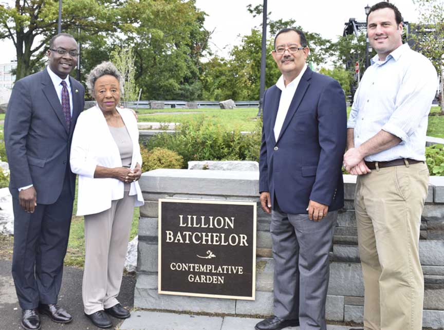
Railroad. The plan proposed additional green space, a re-worked parking layout, an enhanced concession area, an amphitheater and performance plaza, a new family gathering area and shelter, a great lawn and large event space, a contemplative garden, a Freedom Walk to be incorporated throughout the site, and a re-routing of the Riverwalk to create safe separation of activities that enhance both the popular angling area and the multi-modal trailway on the west side of the park. - Buffalo Niagara Waterkeeper, 2019 (online October 2020) |
| 2004
Photos Looking south and west 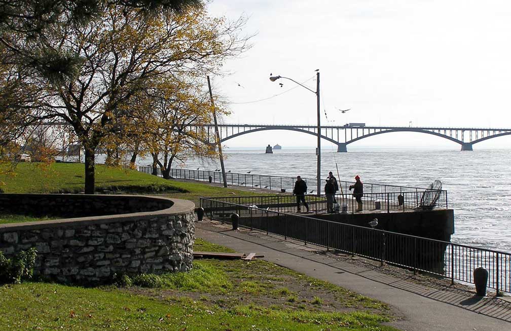 Peace Bridge and Niagara River 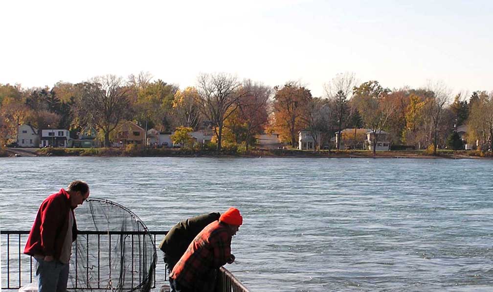 Canada in background 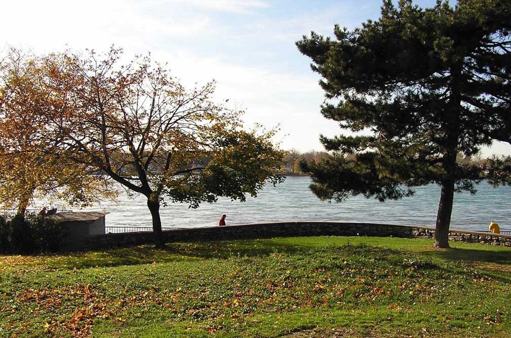 Canada in background 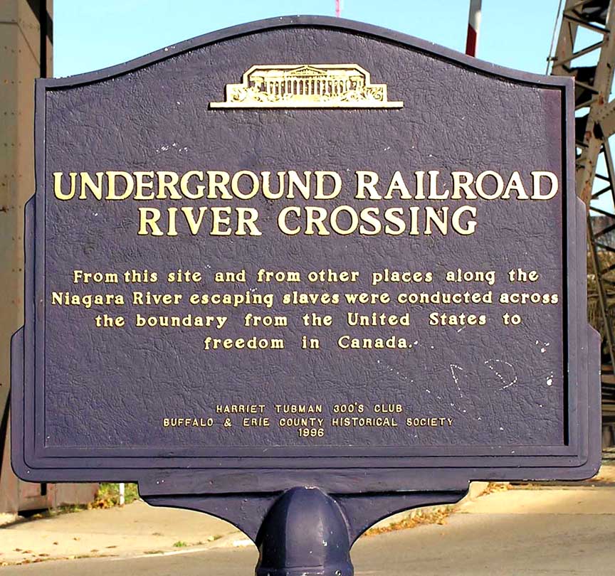 |
  Two details below:
 |
| 2017
Photos Looking north 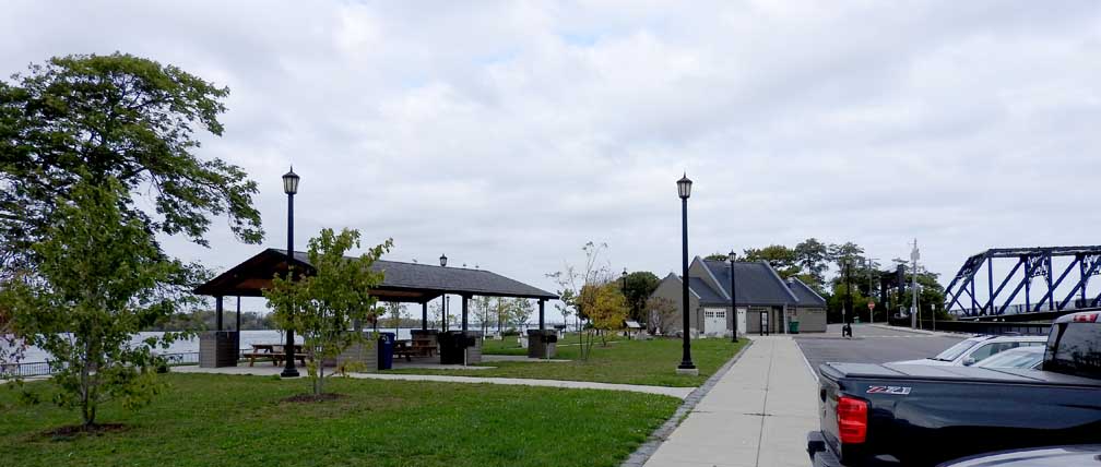 Renovated park: Shelter ... Interpretive Center with Restrooms and Concessions 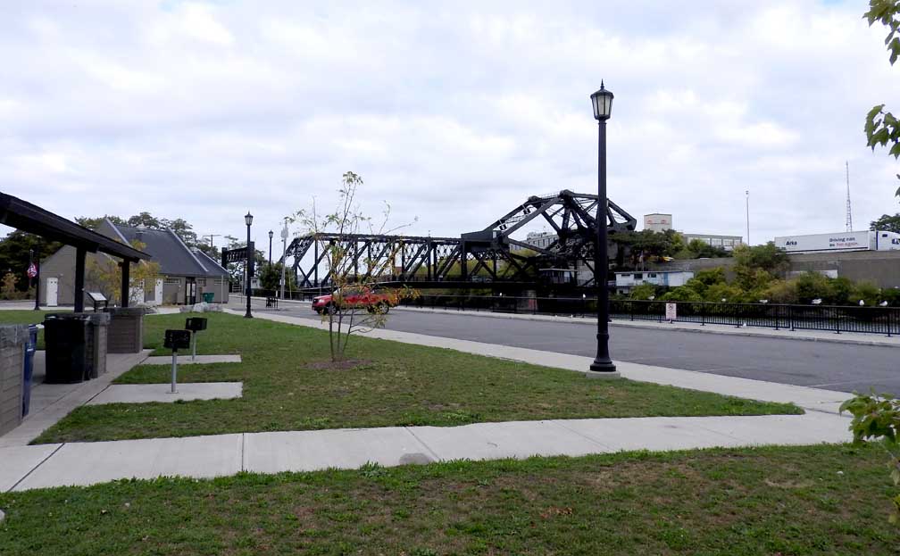 Ferry Street Lift Bridge 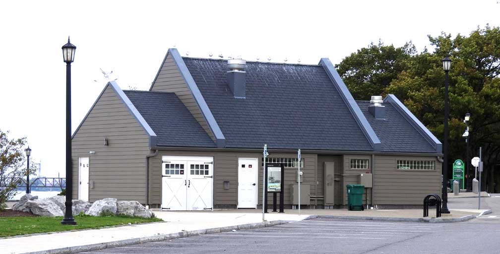 Interpretive Center with Restrooms and Concessions |
| 2017
Photos Outdoor display 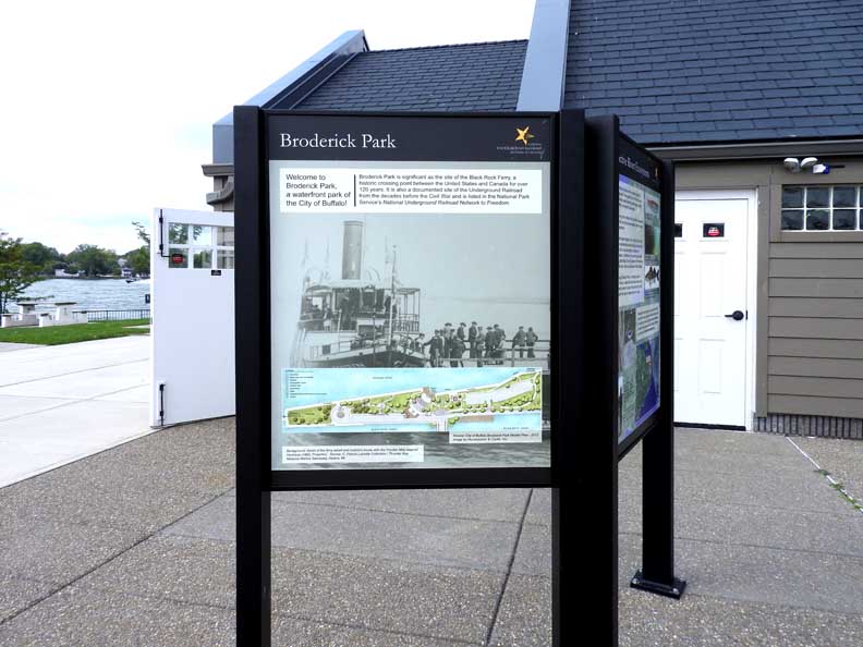 Three details below: 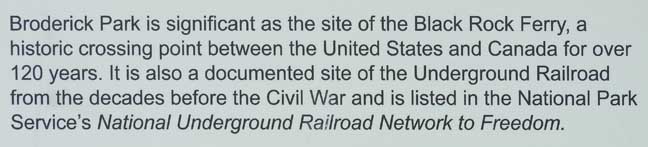 Detail #1 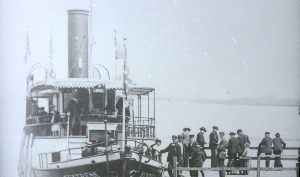 Detail #2 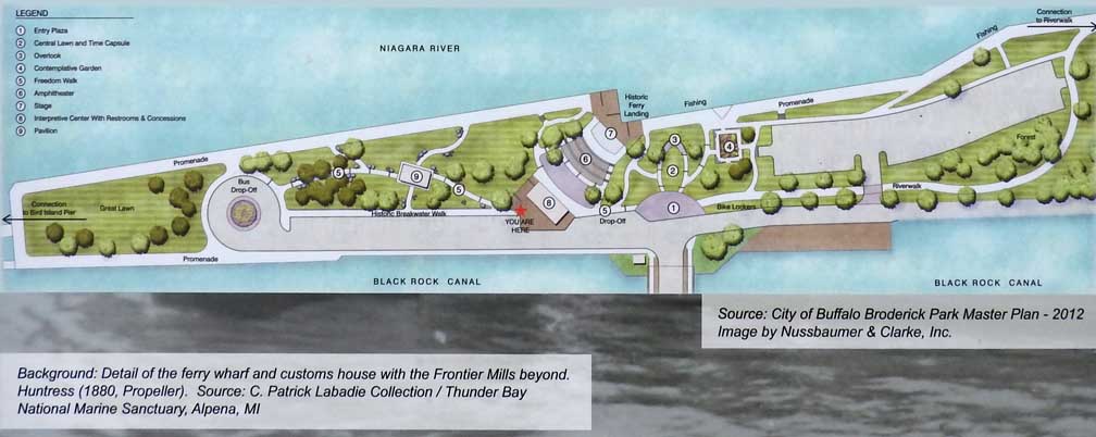 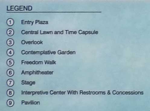 Detail #3 - 2012 Master Plan |
| 2017
Photos Outdoor display  Four details below:  Detail #1  Detail #2  Detail #3 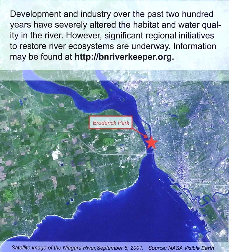 Detail #4 |
2017 Photos Outdoor display  Three details below:  Detail #1  Detail #2 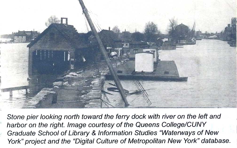 Detail #3 |
2017 Photos Outdoor display 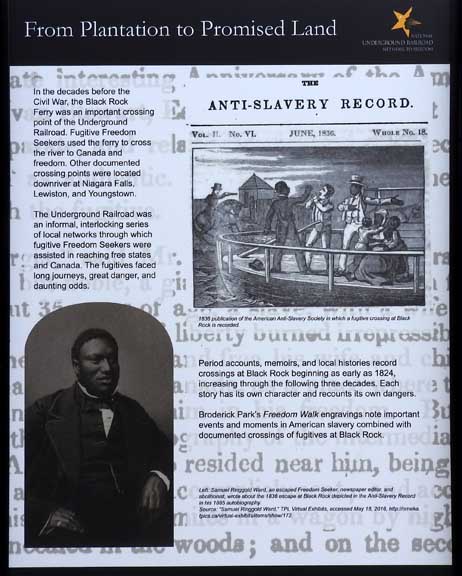 Four details below: 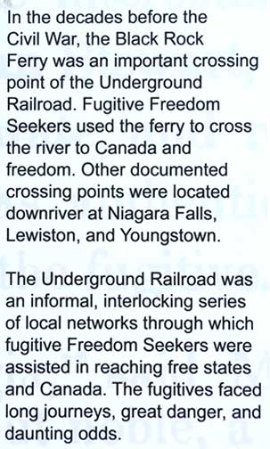 Detail #1  Detail #2  Detail #3 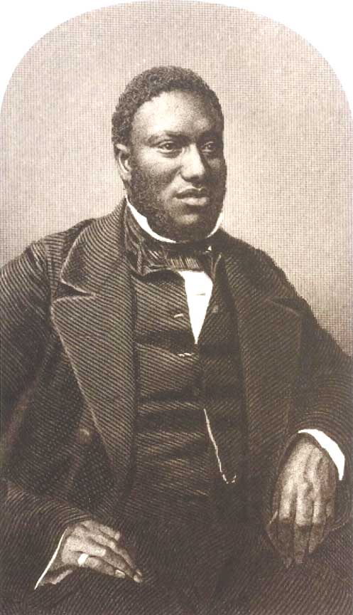  Detail #4 |
| 2021
Photos Outdoor display 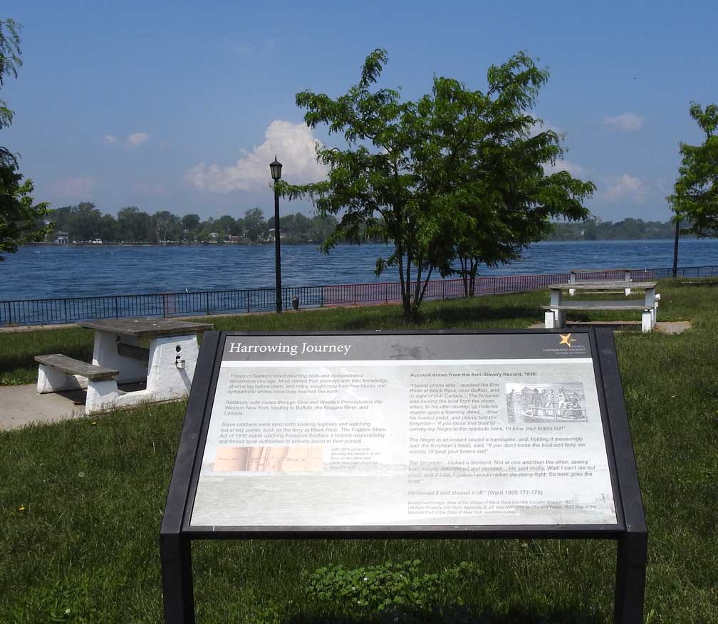 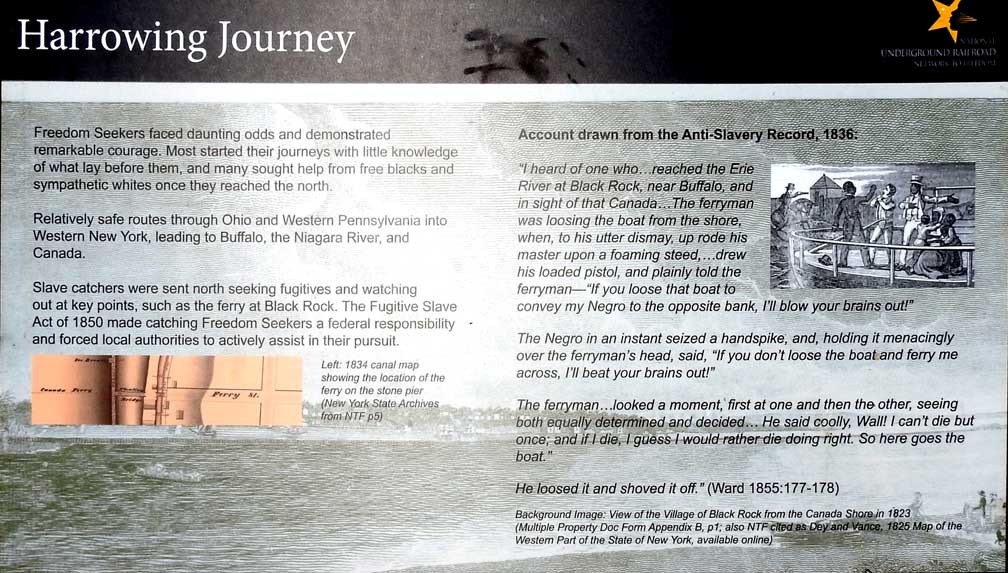 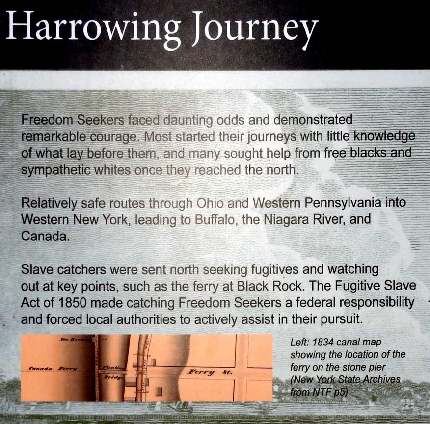 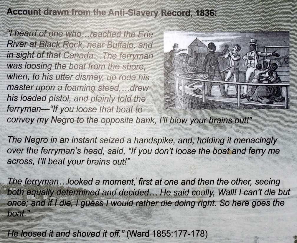 |
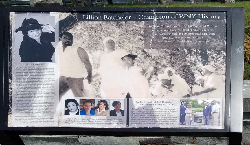
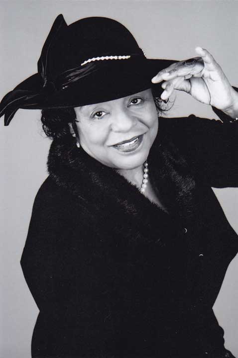
2017 Photos Indoor display 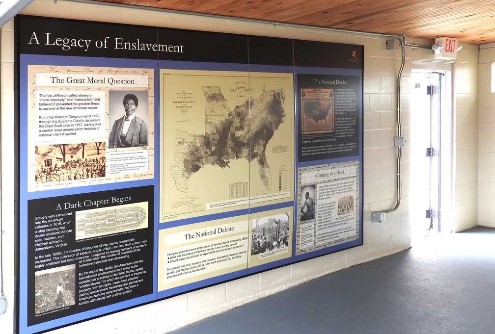 Six selected details below: 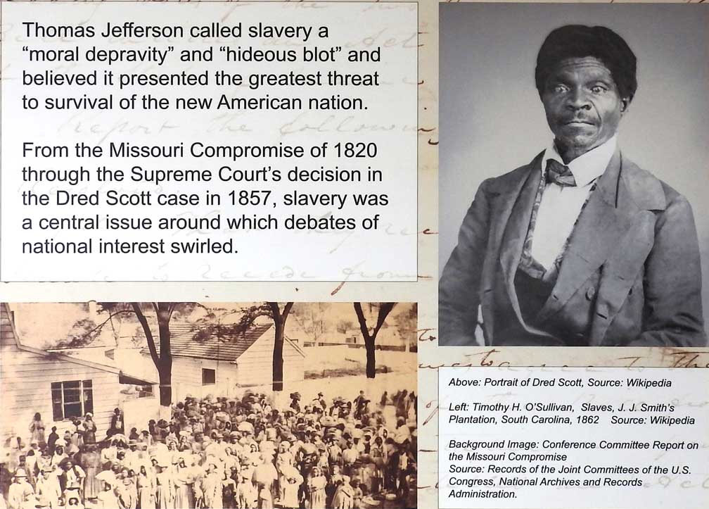 Detail #1  Detail #2  Detail #3  Detail #4  Detail #5 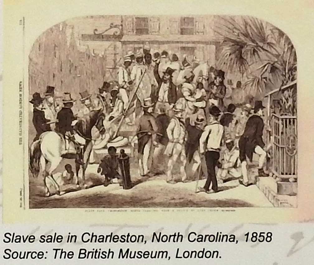 Detail #6 |
2017 Photos Indoor display 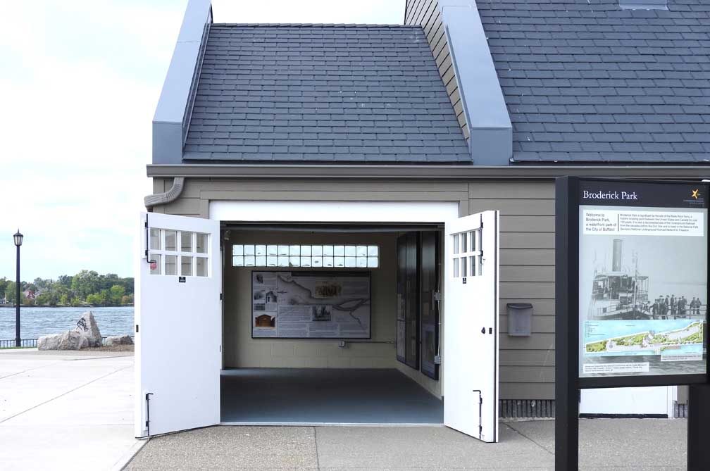 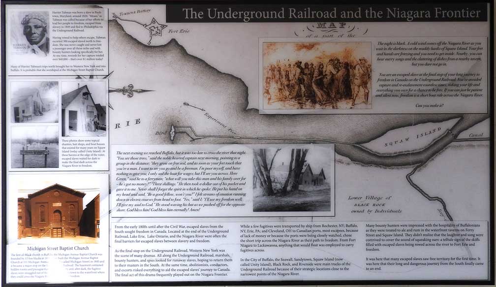 Four details below: Detail #1 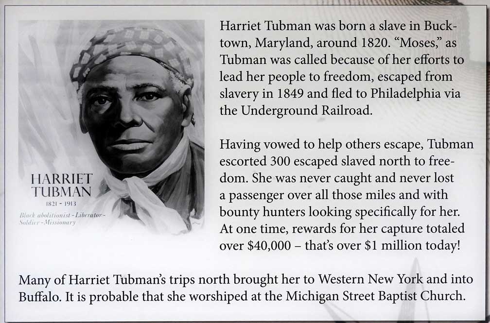
 Detail #2 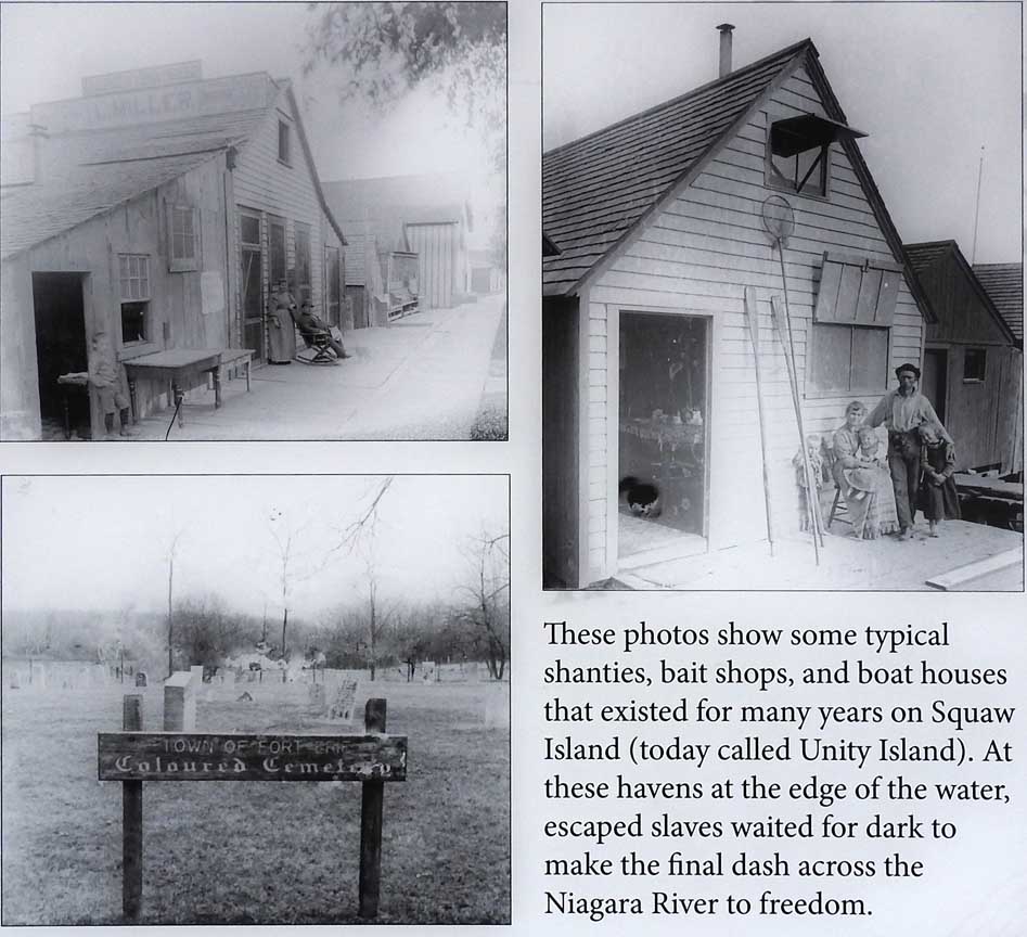 Detail #3 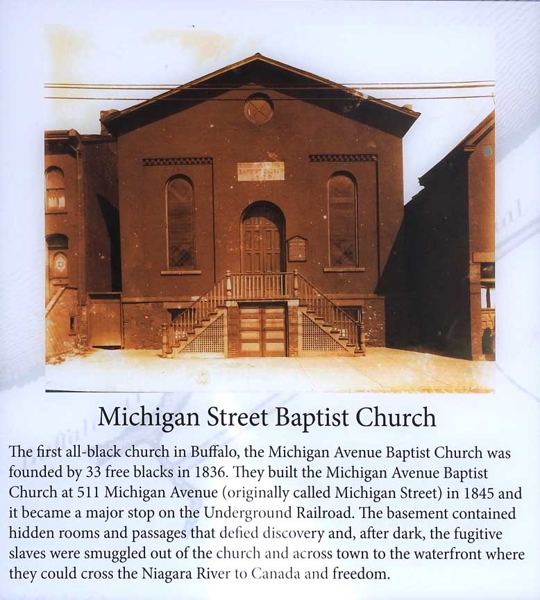 Detail #4 Michigan Baptist Church 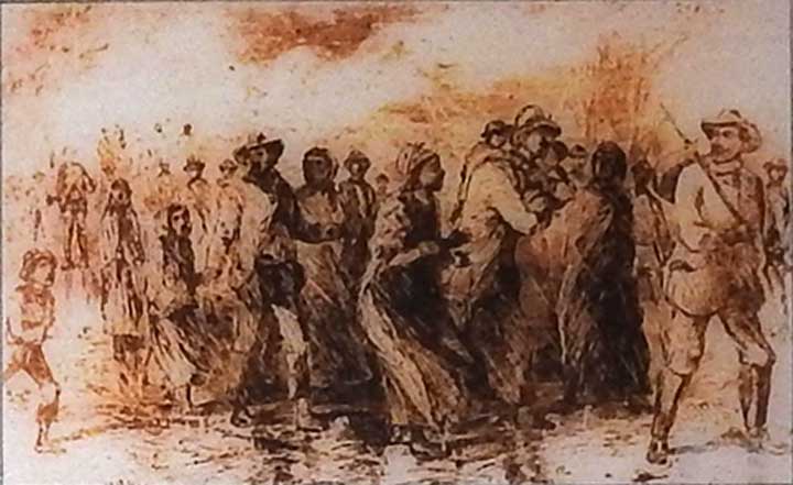 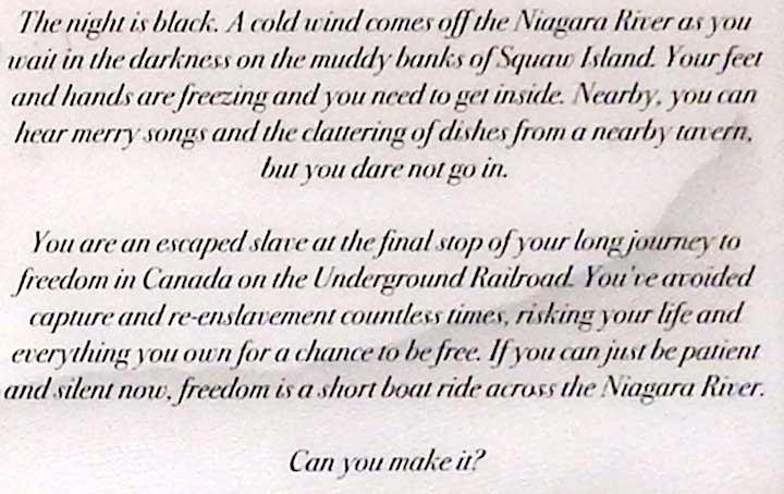 Detail #5 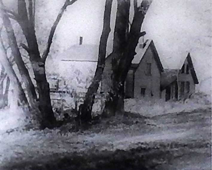 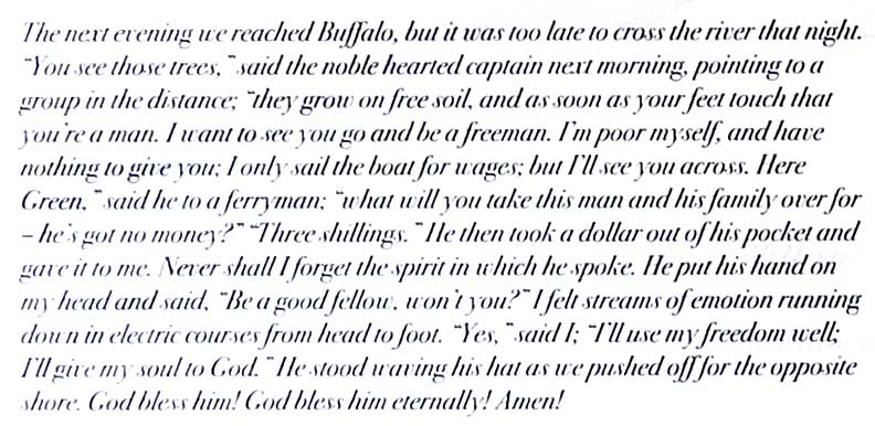 Detail #6 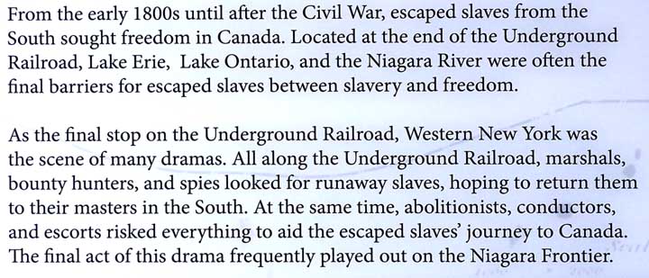 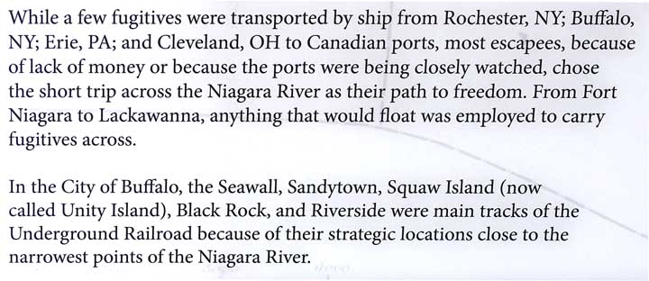  Detail #7 |
2017 Photos Indoor display  Five details below:  Detail #1  Detail #2  Detail #3   Detail #4  Detail #5 |
2017 Photos Indoor display  |