
Buffalo, NY, Maps
See also:
BuffaloResearch.com
Links to Maps (online April
2013)
- 1802 - Original
Land Sub-Divisions of Buffalo Section 11, page 4
- 1802 - Original Land Sub-Divisions
of Buffalo In color
- C. 1804 - Buffalo's Inner Lots
Holland Land Co. lot numbers. Reprinted from History
of the City of Buffalo and Erie County, H. Perry Smith, editor
- C. 1804 - Buffalo's Outer Lots
Holland Land Co. lot numbers. Reprinted from History
of the City of Buffalo and Erie County, H. Perry Smith, editor
- 1804 - Village of new
Amsterdam (later Buffalo)
- 1805
- Buffalo map Has original street names.
- 1812
- War of 1812 map Lossing's Field Book (online
April 2013)
- 1813 - The Earliest Buffalo
including an 1813 Burned Buffalo Map Reprinted from "The Picture Book
of Earlier Buffalo," Severance, Frank H., ed. Buffalo Historical
Society, Vol. 16, 1912, pp. 57-66
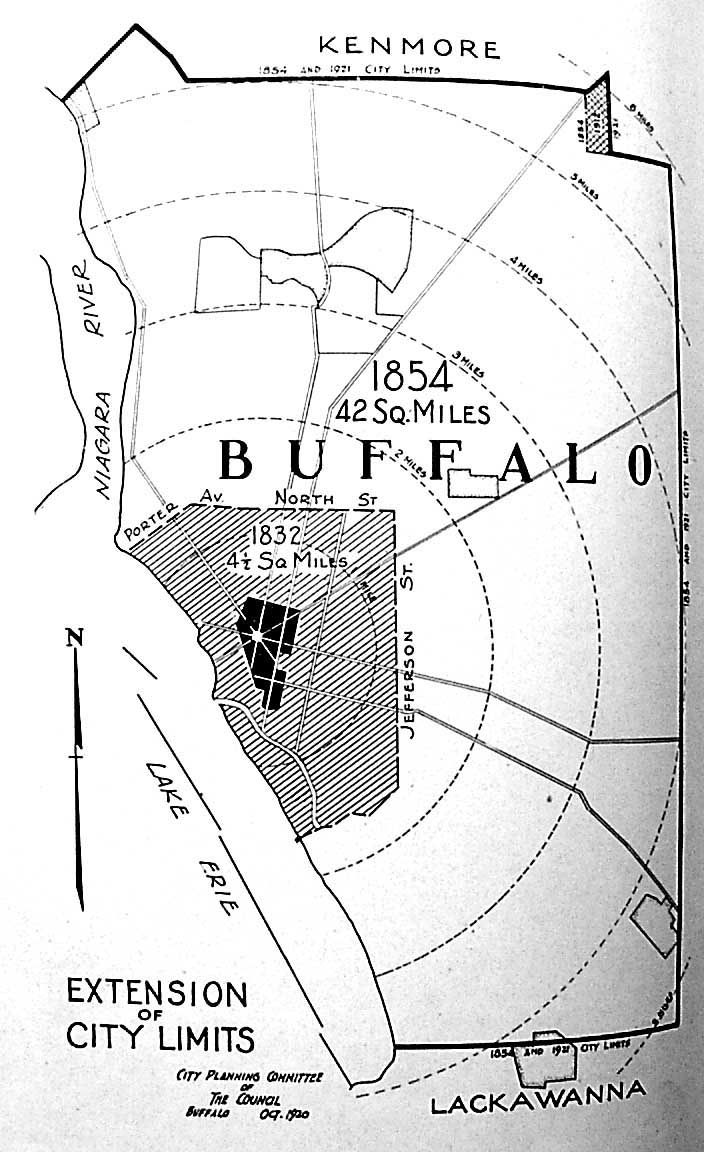
- 1832 - Extension of City Limits - 4
1/2 sq. miles; in 1854 - 42 sq. mile
- 1863 - Bird's Eye View of the City
of Buffalo, NY on display at theBuffalo &
Erie County Historical Society Museum
- C.
1872 - Buffalo Pdf. Click on image for larger size
- 1872 - Erie
Canal Terminus
- 1874 -
Broderick, S. M. Olmsted in Buffalo Maps of
Buffalo parks
(online April 2013)
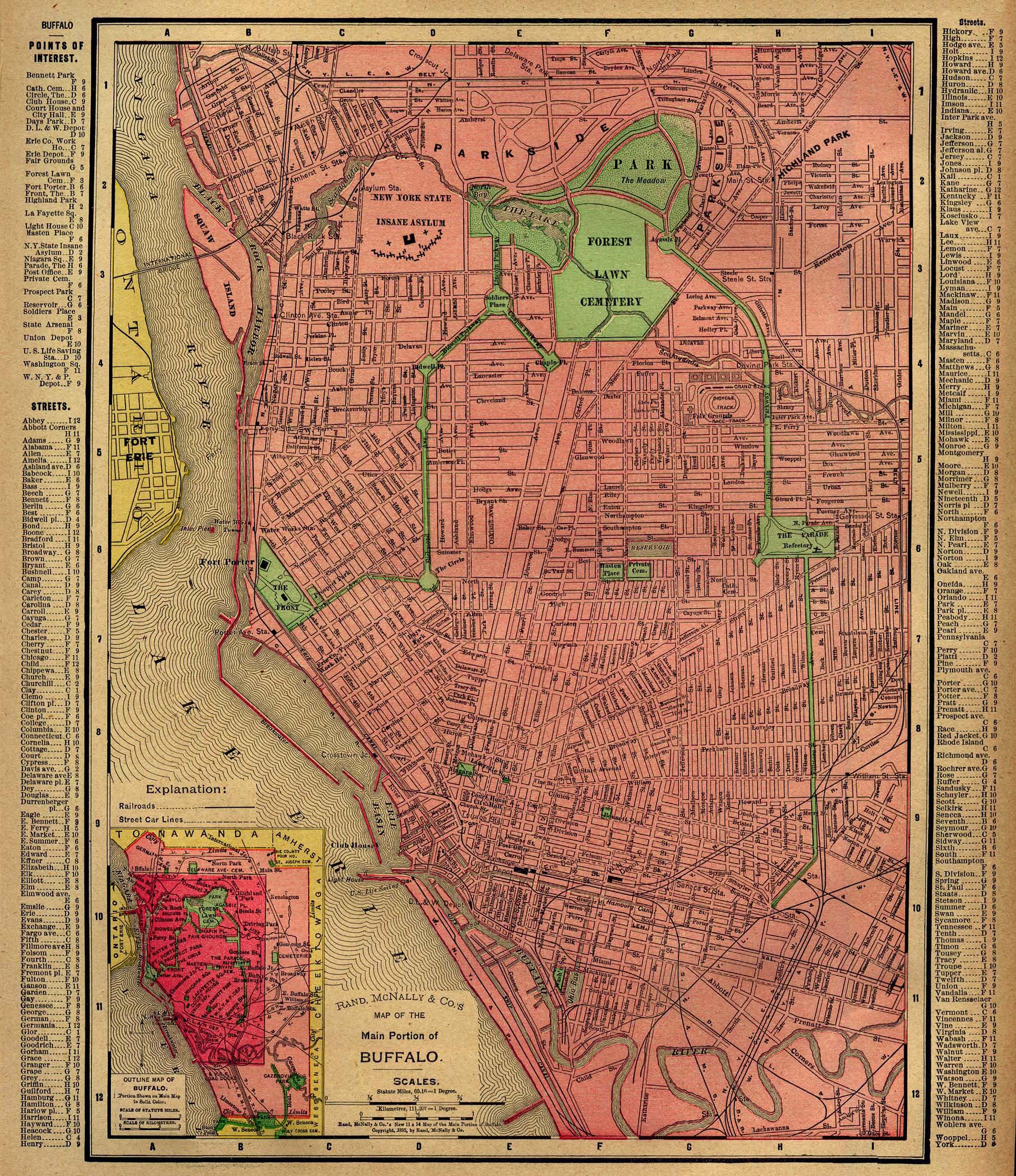
- 1894 - City
of Buffalo Atlas map
- 1896
- Buffalo Posted by the Univ. of Texas at Austin Library
- 1901 - Buffalo (UNH Dimond
Library)
- l902
- Buffalo map
Posted by the Library of Congress
- 1902
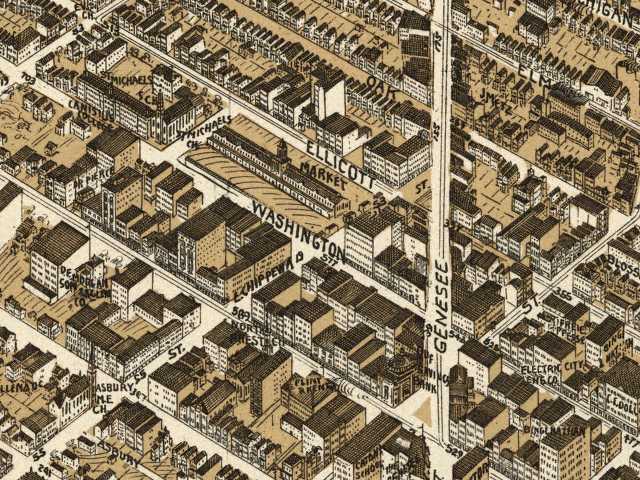
- Washington Market
Map of market and surounding buildings. Taken from a larger
map posted by the
Library of Congress (online April 2013)
- 1905 map
- 1940 - Map of Buffalo
- 1948 - Buffalo by UNH
Dimond Library
(online April 2013)
- 1984 - NY Central
Terminal
- 2000 - Buffalo's
Average Housing Age Distribution (online April 2013)
- 2007
- Google Map of Buffalo Click and drag the map with you (online
August 2013)
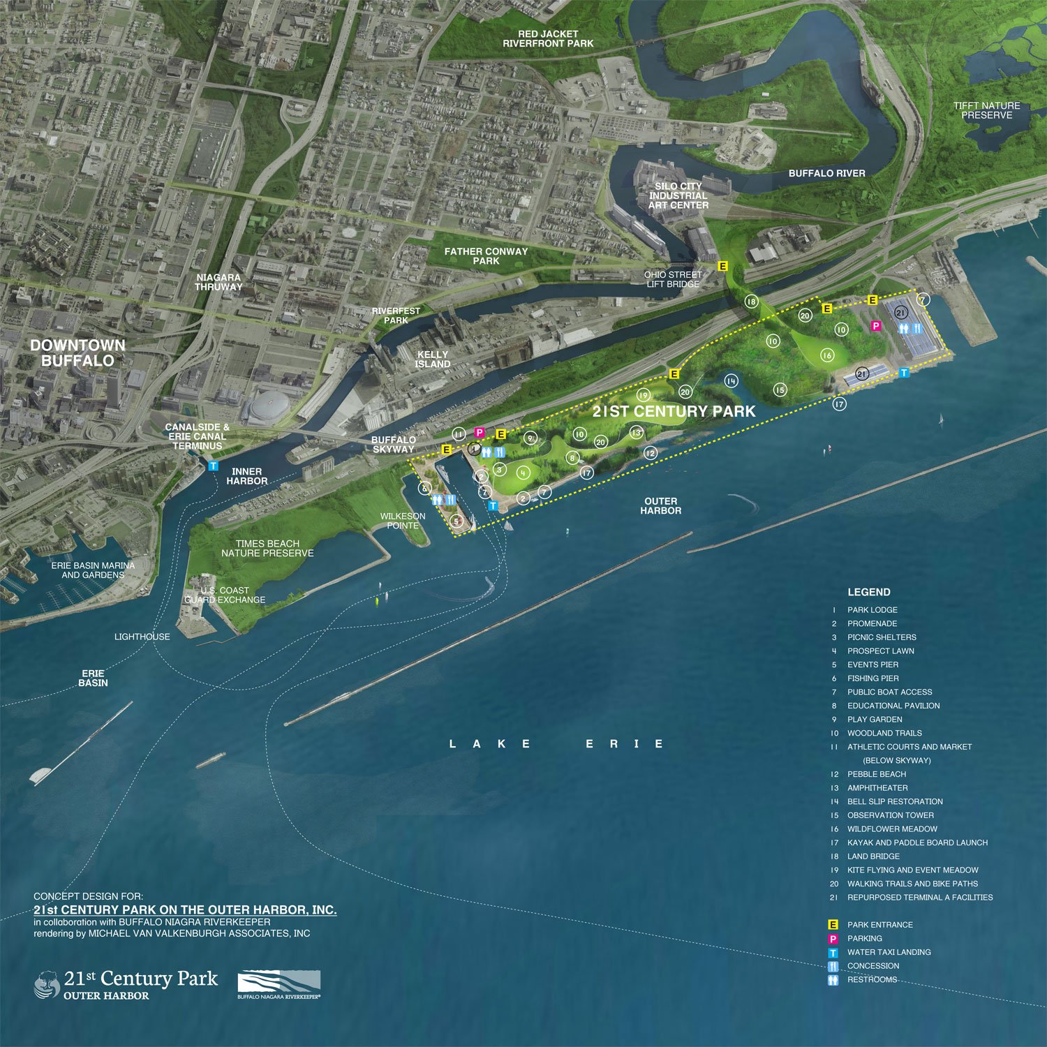
- 2014 - 21st Century Park
Proposal
- ? -
Cobblestone District / Lehigh Valley Site / Inner Harbor Development Photo with
superimposed districts (online April 2013)
- ? -
Electric District Photo with superimposed district
(online April
2013)
Erie
County/Western New York maps:
Page
by Chuck LaChiusa
| ...Home Page
...| ..Buffalo
Architecture Index...| ..Buffalo
History Index... .|....E-Mail ...| .

web site consulting by ingenious, inc.